

Capital Cities as scenes
Below, I list a lot of street props such as a lamp post. Each prop image represents a number. I want to use props 0 to 17 as a way to represent numbers 0 to 179 by using the colour fill of the image as a way to represent the final digit. E.g. If prop 08 is filled with red then it means 089 (9 means 'red' if you look at the Colours article.
Each prop (such as a lamp post) represents a 2 digit number. By default, their colour fill here is blue.
I will list the 50 props by name in alphabetical order; then I will list them enumerated:

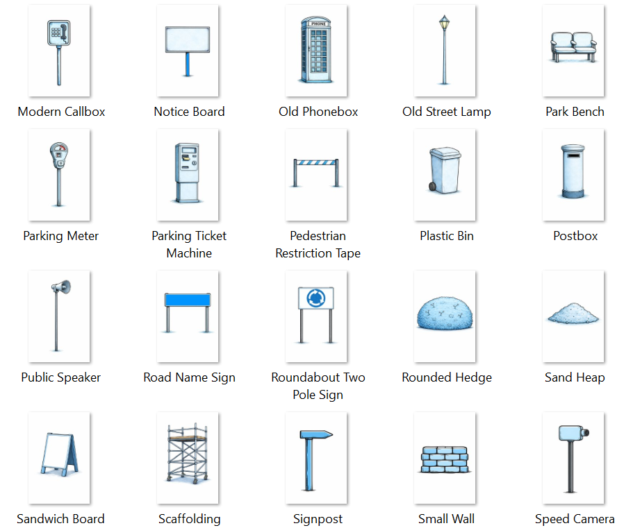
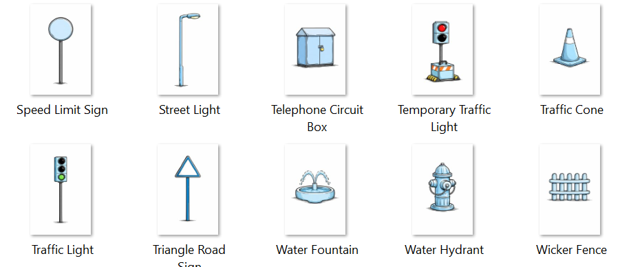
Here are the smae props lsited with two digit number labels::


But I want to represent longitude whole numbers; so I want to express negative numbers as well. I can use props 20 to 37 and have a rule that they mean -0 through to -17 [basically, subtract 20]. Again, colour fill of the prop decides the third digit.
Latitude would need to be between minus 90 and plus 90. So I would use the same approach with the same props. If the prop occurs on the left side of the scene then it means latitude; if the prop occurs on the right side of the scene then it means longitude.
The centre piece of the scene is a basic drawing of a landmark of a capital city. E.g. The Eiffel Tower could be the landmark to represent Paris in France. The same image can be used to represent France - depending on the context. E.g. Id I know that my mnemonic loci are to do with countries then the Eiffel Tower is probably meaning France rather than Paris.
The ground on which that landmark sits is meaningful as well. Different ground shapes imply different flag types.
What would the terrain (the floor) mean?
I would like to make the types of ground indicate the general style of the state's flag:
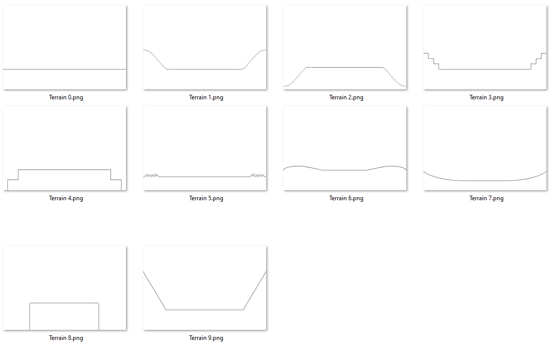
0. Not a good match for the flag styles listed below. [therefore rote learn the design of the flag]:
1. Horizontal Tricolor / Triband (~33%): This is the most prevalent layout globally, appearing in roughly one-third of all national flags. It consists of three horizontal stripes, either with three unique colors (tricolor) or two alternating colors (triband).
2. Vertical Tricolor / Triband (~15%): Popularized by the French Revolution, this style features three vertical stripes. It is a staple design for many European and African nations.
3. The Canton (~12%): This style places a specific symbol or design in the top-left corner (the canton), which usually occupies a quarter of the total area. It is often used to denote a union or a historical lineage.
4. Horizontal Bicolor (~10%): A clean, two-toned design split horizontally. These are frequently used as the base for flags that later incorporate national crests or emblems.
5. Central Charge / Symbol (~8%): Rather than focusing on stripes or divisions, these flags feature a prominent central emblem on a solid or simple background, often representing a sun, star, or religious icon.
6. The Nordic Cross (~3%): A distinct cross where the vertical bar is shifted toward the hoist side. While geographically concentrated in Northern Europe, it remains one of the most recognizable structural styles in vexillology.
7. Vertical Bicolor (~3%): A simple vertical split into two equal fields of color. Though less common than the horizontal version, it provides a bold, high-contrast aesthetic.
8. The Saltire (~2%): This design utilizes a diagonal "X" shape extending from corner to corner. It is a classic heraldic layout that serves as the primary geometry for a small handful of sovereign states.
9. The Triangle / Chevron (~2%): This style features a triangle (or chevron) extending from the hoist side toward the center of the fly, often used to represent progress or a specific geographic feature.
Colour fill of landmark and colour fill of terrain and sky item
Two colours of the flag of the country can be represented as colour fills of the landmark and of the terrain.
I could also do a third colour as a coloured object in the sky. E.g. a cloud. But I would leave the sky plain white in all cases.
Blue, white and red are the vertical striped o the French flag.
Terrain 2 means a verticle tri-colour flag. So I would need that terrain and the Eiffel Tower can be on that terrain.
The latitude and longitude of Paris, France are approximately 48.8566° N, 2.3522° E . I am interested in representing 48 North as 04 with colour fill 8; and 2 East as 00 with colour fill 2.
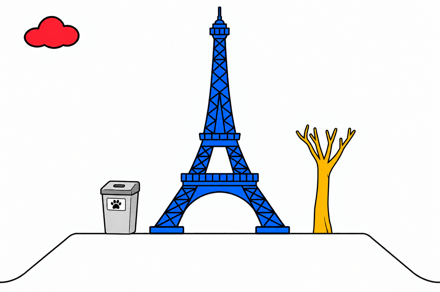
Note: I use clipart style when making landmarks because fine detail is not wanted.
Note: The flag colours from left to right are blue, white and red; so I chose colour fill sof landmark, terrain and cloud accordingly.
Other Country List
Since I made this Bloke Town of country places, I added eye detail to the Animals system (a system of 520 humanoid animals); and many of the animals now prompt a country name: the animal can be visualised as a representation of a particular country. So that makes the benefit of the Bloke Town lessen: animal people can be used instead.
I also wonder if longitude and latitude is as important as knowing more approximately where a city is on the globe. Another article about grids has a way of representing the globe as 36 squares across and 18 squares high; maybe the choice of 36 and the choice of 18 could be part of a mnemonic for where a city is; and if each square is itself expressed as 5 by 5 squares or some other slicing then that mini square might also be part of a mnemonic representation of where a city is located.
I am keen to keep this article here though because the municipal props could be handy for solving other mnemonics challenges.